Sunday, December 16, 2012

El Cañon del Pato y la Cordillera Blanca, Perú

Perú begins to solidify its identity as we move upwards into the mountains- not surprisingly where the Indigenes have lived and left their mark for thousands of years and have since been marginalized in modern times..  This voyage through the Cordillera Blanca is breathtaking - both from its beauty but also due to its elevation.  We are mostly above 3000m and have slept at 4200m and hiked up to 4700m.  

Le voyage à travers la cordillère blanche nous a coupé le souffle dans les 2 sens du terme par sa beauté mais aussi par son altitude. On a passé la plupart de notre temps au-dessus de 3000m, dormi à 4200m et marché jusqu"à 4700m d'altitude. 

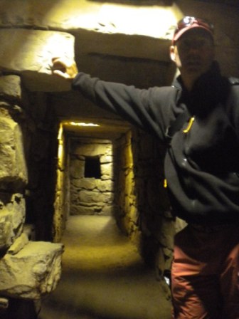
To get there we started the journey by following the River Santa into the Canon Del Pato (Canyon of the Duck) where we saw the inside of the belly with some 35 hand dug tunnels.

Pour atteindre la cordillère blanche; nous avons traversé le canyon del Pato (le canyon du canard) avec ses 35 ou plus tunnels.
Canyon del pato

Canyon del pato

Canyon del pato


In the last video, the drive to Cajamarca left us tipsy and dizzy with vertigo (and a bit timid of oncoming traffic!) but the lack of oxygen in the mountains leaves us breathless; and not a little bit cold too.  Laguna Paron (after digging out of the mud) was a glacier fed lake at 4200m.  Later we visited Laguna 69 even higher in a mountain bowl whereas the pre-Inca archaeological  site of ancient pilgrimage and finally our visit to the rare Puya Raimondii trees, all in the Huscaran National Park, drove us to almost 5000m.  

Dans la dernière video, la route jusqu'à Cajamarca nous a laissé étourdi et avec le vertige (et un peu peureux avec la circulation en sens inverse), mais le manque d'oxygène dans les montagnes nous a laissé à bout de souffle, et gelés... Laguna Paron (après s'être embourbés) est un lac alimenté par les glaciers à 4200m d'altitude. Plus tard, nous avons grimpé jusqu'à la Laguna 69, une superbe randonné encore plus élevé (on a marché jusqu'à 4700m d'altitude dans le creux des montagnes, puis visité le site archéologique pré-inca Chavin de Huntar, ancien lieu de pélerinage et finalement notre visite des Puya raimondii, des arbres rares (qui me font penser à des danseuses tahitiennes) le tout dans le Parc National Huscaran qui nous a conduit à près de 5000m d'altitude.

At the Laguna Peron we, erm, went a little too far and found ourselves a bit 'stuck in the mud', but Bippers amasing 4wd system got us out of a bind with the help of the sand-plates.  Cleaning up was a bit more of a challenge as the water was cooooold!

A la laguna Paron, nous nous sommes embourbés dans de la glaive gelée. Il a fallu creusé, mettre des pierres, etc pieds nus puis aller rinçé le matériel dans le lac gelé... 

Laguna Paron


Lagunas Llanganuco
This section was the prettiest part of the Andes we have seen to date.  The mountains climb upwards over 6000m elevation and have snowy caps.  Lakes are emerald green and glacier fed.  Waterfalls are omnipresent.  Our climb up to Laguna 69 took us to 4700m and we lost our breath - AND we lost our backup fog-lamps.  'I will keep an eye on your car, no worries' are some famous last words.

Cette partie des Andes a été la plus belle que nous ayons vu jusqu'à présent. Cette région montagneuse du Pérou est pleine de lac émeraudes entourés de glacier, de pics enneigés et de cascades. La randonnée qui nous a amené jusqu'à la lagune 69 en est un bel example.


Hiking Laguna 69

Hiking Laguna 69

Hiking Laguna 69

Laguna 69
Laguna Llanganuco
Exhausted and frustrated by really bad dirt roads (cheers for Bippers for keeping her legs under her this time!)  we decided to take a TOUR to the ruins of Chavin.  We stopped for the compulsary photo-op with dirty frozen children with their fluffy baby animals...at Laguna de Querococha.  Fanny took her coca tea.

Fatigués par les routes non pavées, nous avons décidé de laisser un peu de repos à Bip Bip et au chauffeur et de prendre une excursion organisée pour visiter les ruines de Chavin. Nous avons fait un arrêt à la lagune de Querococha où j'ai pu prendre mon thé aux feuilles de coca, très bon pour lutter contre le mal de l'altitude.

Laguna Querococha
The ruins of Chavin were constructed as a pilgramage site way before the Incas way back between 1200-800 BC.  They say they are the most ancient evidence on the continent.  All about peace and mathematics I hear...

Les ruines de Chavin ont été construites entre 1200 et 800 avant JC par une des civilisations les plus anciennes du continent.
Chavin de Huntar

Chavin de Huntar


Chavin de Huntar


The final scenes of the Cordillera Blanca found us climbing yet again over 4500m in the rain and cold to check out the famous and interesting Puyas Raiimondi trees.  Folks cuddled in tiny stone huts with wisps of wood smoke spoke of an ancient past.

Voilà la dernière partie de la Cordillère Blanche que nous avons exploré: encore des lacs mais surtout les arbres Puyas Raiimondi, les minuscules maisons en pierres où vivent les amérindiens de cette région et un pietroglyphe.


Puyas Raiimondi

Puyas Raiimondi


Our long drive from Nasca to Cusco crossed the Cordillera above the 4000m (twice) until we descended into Cusco at 3500m.  Piece of cake.....  It will be a long time now before we see the sea.

La route entre Nasca et Cusco traverse la Cordillère (pas la blanche) 2 fois jusqu'à la descente à Cusco à 3500m. Les doigts dans le nez!!! Nous ne reverrons pas la mer d'ici peu...


Sunday, December 2, 2012

Ramble on, Peru

After the warm reception of Colombia and then the warmer embrace of Ecuador we are finding Peru a bit troubling.  We are having a hard time coming to grips with Peru and its identity.  For example, we find,  at times, ourselves thinking we are in Burkina Faso or Sudan or Mali – brief some lost, poor, dusty, dry crumbling mud-brick African landscape, and needing a wake-up reality shake.  The fabled beach at Máncora seemed an overly rustic cut-paste of KaoSan Road Bangkok in the worst connotation.  There were times north of Trujillo where I found the rubble and garbage piles and desert not any different than southern Iraq.  The gap between the rich and the poor is much greater here than we have seen since Guatemala – and that might have something to do with the strikingly high percent (45%) of the population indígenas.  Folks are in survival mode, less inclined to accept whimsy – and maybe it is the greater tourism here than either Colombia or Ecuador that leads folks to be less accommodating to foreigners.  We have been challenged by coppers here for the first time since Nicaragua and we are having to redefine our margins.

There have some notable and exciting moments and landscapes too – Chiclayo-Chachapoyas-Cajamarca route, some 840kms gave us chills and thrills as we drove the high sierras on barely-wide-enough goat tracks perched on vertigo-giving, cloud high, cliffs of doom.  I doubt much (we will see) if the Bolivian Death Road can even compare...   This is where we were able to march to and salute the third highest waterfall in the world, and to clamber over the ruins of Pre-Inca hand-made! table-top terraced fortress of Kuelap.  We check out the Laguna de Condor mummification program at a cool museum in Leimebamba.  For the first time we had a ‘private’ hotspring  (HOT HOT DAMN HOT) bath at Baños del Inca where we got to steam-soak degrime after 4 days of rough dirt track driving and unserviced boondocking.  The beach at Huanchaco (out of town, with the fishermen and their reed 'caballos') was restful, proving to be the best pacific beach since Costa Rica, well Cojimes, Ecuador was really nice too.


Après l'accueil super chaleureux des colombiens puis des équatoriens, on a été refroidi par les premiers contacts avec les péruviens, en tout cas sur la côte (peut-être du à la grande affluence de touristes). Bizzarement, on est monté en altitude, perdu quelques degré et rencontré des gens plus sympas et des paysages époustouflants. 

Influencés par d'autres blogs, nous nous sommes lancés dans une route non pavée dans les montagnes entre Chachapoyas et Cajamarca. Cette piste nous a donné des frissons et des sensations fortes: nous avons roulé sur des chemins à peine assez larges pour Bip Bip, perchés sur le flanc de la falaise de telle façon que çà nous donnait le vertige. Nous doutons que la route de la mort en Bolivie puisse faire concurence (on verra!). C'est là que nous avons pu marcher et saluer la troisième cascade la plus haute du monde, celle de Gocta, et grimper sur les ruines pré-inca de Kuelap. Nous avons également jetté un oeil au musée de Leimebamba avec son incroyable collection de momies, qui ont été retrouvées à l'inaccessible lac des condors.

La fin de la route nous a mené à Baños del Inca où pour la première fois, nous avons profité d'un bain thermale privé, ce n'était pas de trop après 4 jours de camping sauvage dans les pistes poussièreuses.
Enfin, repos bien mérité pour le chauffeur, sur la plage de Huanchaco, qui s'avère être une des plus belles plages du Pacifique depuis le Costa Rica quoique Cojimies en Equateur était très agréable aussi.


Saturday, November 17, 2012

Le coeur de l'Equateur


Je ne sais pas trop quoi raconté mise à part qu'on a beaucoup aimé l'Equateur. On a continué notre périple dans les hauteurs qui contraste pas mal avec la côte du pays.

We really grooved on Ecuador - the price was right, the folks outstandingly helpful, the ROADS so smooth and new, the 3-day-in-jail-for-speeding made driving so nice and calm (mostly), the beaches nicely juxtaposed with the mountains which fit nicely with the Amazonian jungle. Free access to some of the best National Parks.  Warm days, cold nights. All nice contrasts.

Tout d'abord, j'ai trouvé dans le guide du routard un village réputé pour son fromage, son chocolat et sa charcuterie alors je n'ai pas laissé le choix à Chris (pas vraiment difficile à convaincre) et nous y avons foncé! Et c'était sans regret car même la route qui y menait était magnifique. La route nous a fait grimper à plus de 4200 mètres d'altitude et  passer au pied de l'impressionnant volcan Chimborazo et ses lamas sauvages.

Fanny scored a free French travel guide where...?...oh yea the place known for cheese and chocolate and sausages.  She was in a French kind of heaven- if the French can ever contemplate being outside of Paris.  So we packed on the kms climbing to over 4200m and back down to the sea to the beaches.  The high flat-lands of the snow-capped Chimborazo where we caught the first sight of wild lamas (vicunas)...

Ambiance différente mais pas moins agréable à Baños, où nous avons passé quelques jours. C'est vraiment le pays des cascades. Nous avons même osé visité un zoo avec un peu de réticence pourtant nous devons avouer que ça nous a bien plu... et faire un descente en tarabita, petite nacelle pendue à un câble, accompagnés par le chien de la propriété.

A different ambiance - all sport and thrills - was no less agreable in Baños.  The land of waterfalls it seemed hosted one of the best zoos we ever visited (not that we support or agree with zoos) and then we did a screeming sliding decent on an Astec (twentieth century version) tarabita with our new friend, the local pooch.

La boucle de Quilotoa était superbe: visite de jolies marchés nottamment un marché aux bestiaux (lamas, cochons, poules...), contemplation du lac et route entre des volcans.

We cruised the Quilotoa loop for the local colorful markets - and more fun the ANIMAL markets full of Cuy and rabbits and lamas and pigs on ropes all destined for the...erm...kitchen.  We also enjoyed the scenery of high lakes and snowy volcanos.

Puis, encore un autre volcan celui de Cotopaxi avec son sommet enneigé et sa forme conique parfaite qui nous a époustouflé au moment du coucher de soleil. Malheureusement, en sortant du parc notre pare-brise arrière s'est brisé en 1000 morceaux mystérieusement. Et là, ça a été le début d'une autre aventure pour le remplacer!

There is more!- we grunted up Cotopaxi to the end of the trail, but decided against climing the remaining few meters to the refuge, for a top-of the world view around before skidding down back to the lake for a night's chilly camping but a stunning sunset over the volcano.  Leaving the next morning is when our rear window shattered into a billion pieces with a resounding explosion.  Yet another adventure sourcing parts lead us to finally just making one - and THAT is possible.  What a place.

Enfin, le sud avec Cuenca et le parc national de Las Lajas puis plus au sud celui de Podocarpus où nous avons randonné littéralement sur la cime de la montagne. Pourquoi se priver des parcs nationaux en Equateur puisque leurs entrées sont gratuites et qu'il semble qu'ils soient tous plus beaux les uns que les autres!

Finally (not finished yet) off to Cuenca and the National Park Las Lajas and later a bit farther south the reserve Podocarpus known for the tree (another fancy pine tree as far as I -the forester- can figure out).  Better yet was the excessively difficult climb up the the top of the mountain and around the scary-narrow crest back to the refuge and Bippers.  We found that the NPs in Ecuador were some of the best we have yet visited. Ever.  Nice job Ecuador.

Vraiment l'Equateur, j'adore!!!!!!!!!!  Ecuador ranks #1 in our books now.

Statistiques Equateur:

Nombre de jours passés en Equateur/days in Ecuador: 42

Nombre de km parcourus/Kms made: 4368

Bugdet moyen par jour pour nous 2 (maintenance du véhicule comprise): 38,65 euros
Average cost per day: $50 USD

Repas incroyable: cochon d'inde à la broche (cf page repas incrediiiible)
I am particularly fond of the BBQ full spit roasted PORK!

Tuesday, November 6, 2012

La costa pacifica, Ecuador


Quand on pense à l'Equateur, ce ne sont pas forcément ses plages qui nous viennent en tête et pourtant... Nous avons longé la côte de Esmeralda à Canoa. Ce n'était pas forcément la meilleure saison ni pour le climat (saison des pluies) ni pour observer les baleines que nous tentons de voir depuis le Canada (je commence à me demander si ce n'est pas une légende comme le monstre du Loch Ness?!?) mais nous avons été agréablement surpris par cette côte entre les plages désertées de Cojimies, la jolie île de l'argent (isla de la Plata) avec ses fous à pattes bleues, les pêcheurs de Puerto Lopez et le coucher de soleil sur la plage de Canoa.

When one thinks of Ecuador, beaches do not normally come to mind.  However, we cruised the coastline  from Es;eralda to Canoa and found some of the nicest beaches to date.  Bummer we didn't have the greatest weather due to the seasonal rains and bummer we just missed the baby-whaling season too (we have conveniently missed every season since Mexico..) but we have been truly surprised by the deserted beaches of Cojimes, and the 'poor man's Galapagos' at the Isle de Plata was, what we hear, way cheaper and just as anamalistic as the real Galapagos AND the hatching season for the Blue-footed Boobies.  Our best sunset to date can be considered off the beach of Canoa.